Site Plans
The Full Picture, From Above
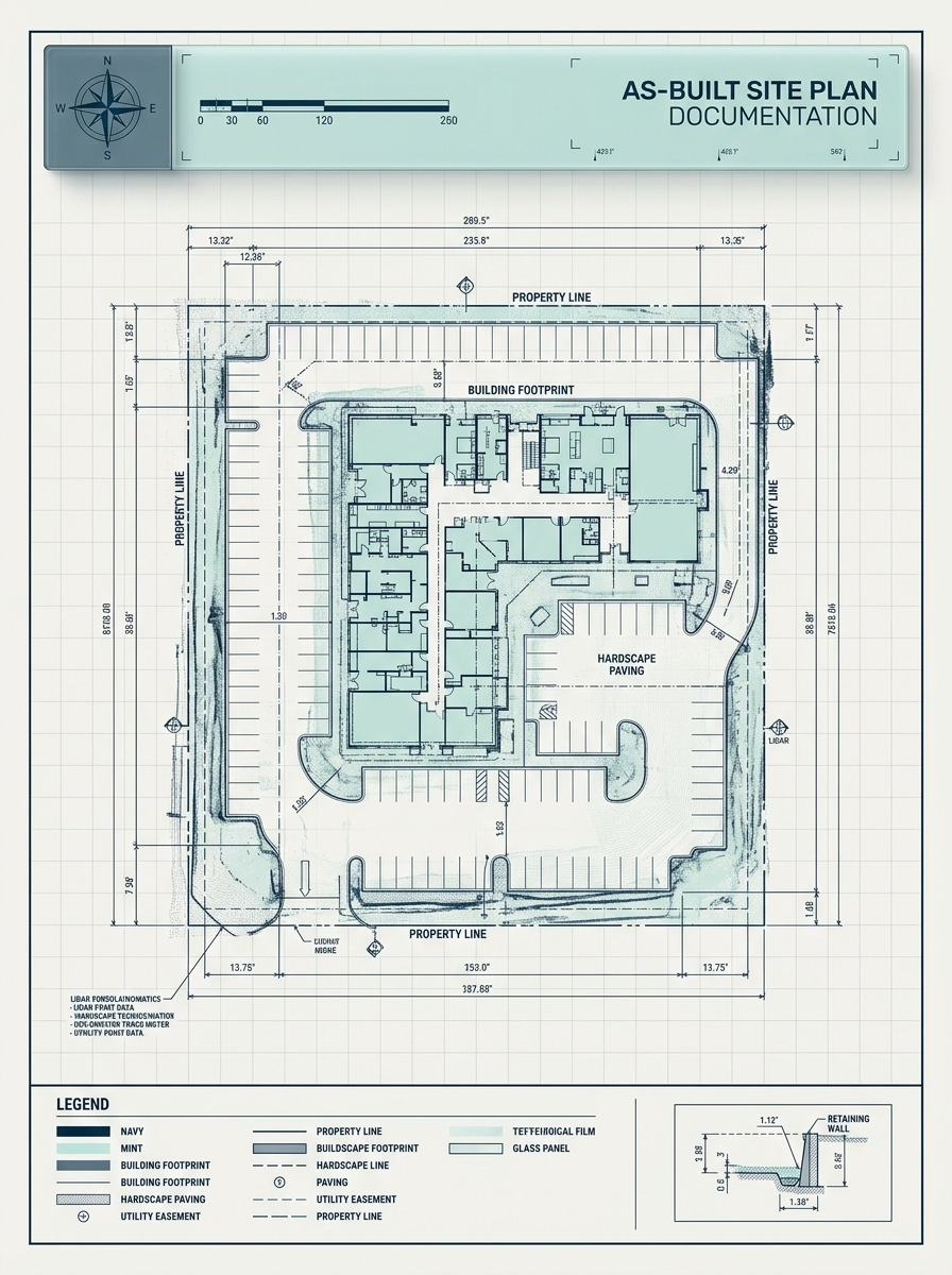
We produce accurate, dimensioned site plan drawings that document the complete relationship between a building, its footprint, and the surrounding property — captured from scan data and drafted to permit-ready standards.
Document What Exists Before You Design What’s Next
A site plan is more than an overhead view — it is the authoritative record of a property’s existing conditions. Where the building sits on the lot, how structures relate to one another, where setbacks and easements fall, what site features already exist. Without an accurate site plan, every decision made downstream carries risk.
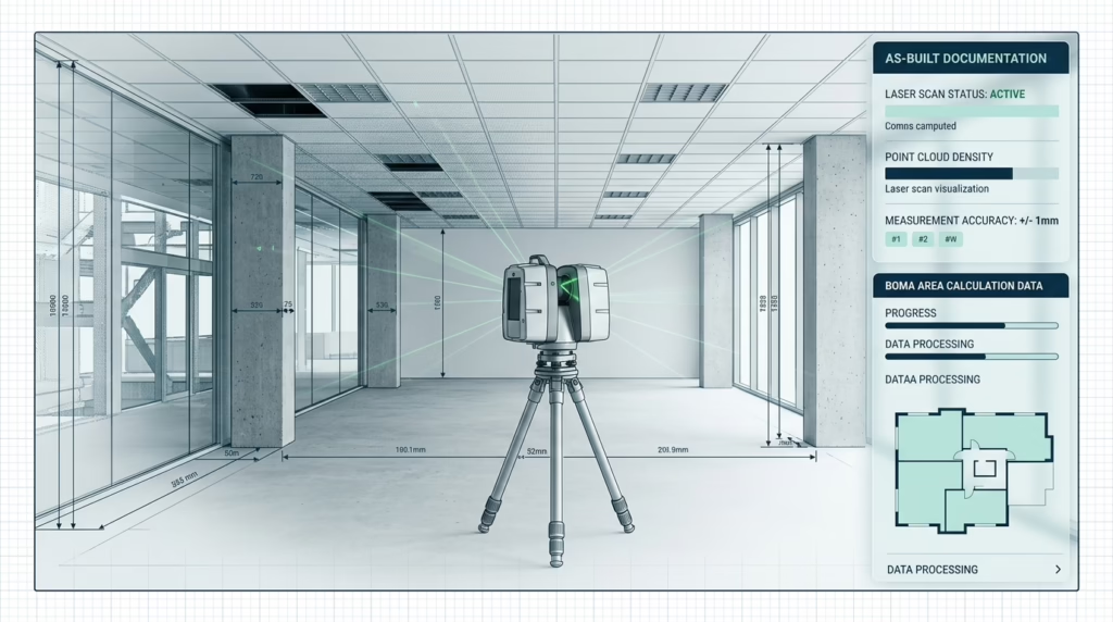
We capture site geometry using ground-level LiDAR scanning combined with measured survey data, then draft a clean, fully annotated site plan in AutoCAD or Revit. Whether you need a single-building residential lot or a multi-structure campus, the result is a permit-ready drawing you can rely on from day one of design.
What Every Site Plan Includes
- check_circle Building footprint with overall dimensions and setbacks
- check_circle Property boundary lines and lot dimensions
- check_circle Driveways, parking areas, walkways, and hardscape
- check_circle North arrow, scale bar, and formatted title block
Every Layer of Your Site, Documented
Our site plans capture far more than the building outline — we document the full site context your design team needs to move forward with confidence.
Building Footprint
Precisely measured exterior outline of all structures on the property, including attached garages, covered porches, and outbuildings.
Property Boundaries
Lot lines, frontage dimensions, and setback distances documented from recorded deeds and verified against physical site features.
Hardscape & Access
Driveways, parking layouts, walkways, retaining walls, and other paved or constructed elements that define how the site is used.
Utilities & Site Features
Visible utility connections, drainage features, grades, and any existing site elements relevant to permitting or future construction.
Types of Site Plans We Produce
From a single residential lot to a multi-building campus — every project type and permit requirement is covered.
Residential Lot Plans
Accurate footprint and lot documentation for single-family homes, ADU additions, and residential subdivisions requiring permit submission.
Residential & ADUCommercial Property Plans
Full site documentation for offices, retail centres, and mixed-use developments — including parking counts, drive aisles, and loading zones.
Office & RetailIndustrial Site Plans
Large-footprint site documentation for warehouses, logistics facilities, and manufacturing campuses with multiple structures and complex site circulation.
Industrial & LogisticsCampus & Institutional Plans
Multi-building campus documentation for schools, healthcare facilities, and civic institutions where an accurate master site plan drives all future development.
Education & HealthcarePermit & Zoning Plans
Drawings formatted to meet local authority submission requirements — correct scale, title block, north orientation, and all required annotations included.
Planning & PermittingReal Estate & Leasing Plans
Clean, styled site plans for property listings, investment packages, and lease negotiations — showing building footprint, parking, and site context at a glance.
Marketing & LeasingOur Proven Process
1. Site Scheduling
We review the property size, access conditions, and any permit requirements before scheduling the site visit.
2. On-Site Capture
Our team measures the full site perimeter, building footprint, and all relevant site features using LiDAR scanning and precision hand measurement.
3. CAD Drafting
Captured data is drafted into a fully dimensioned, annotated site plan in AutoCAD — clean, layered, and formatted to your required scale.
4. QA & Delivery
Every drawing is cross-checked against field data and peer-reviewed before being delivered as DWG and PDF, ready for permit submission or design use.