LiDAR Surveying
Millions of Points. One True Picture.
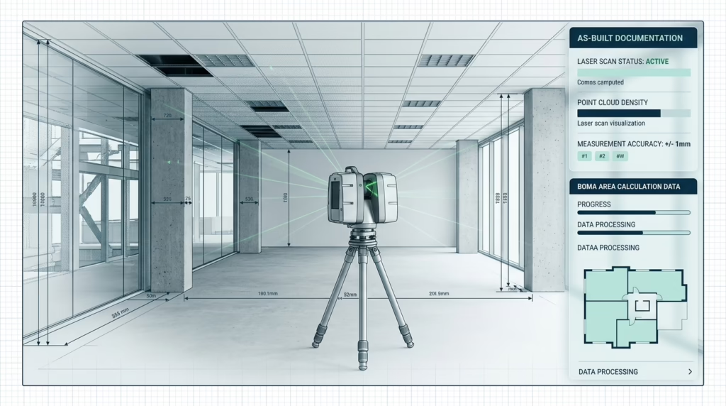
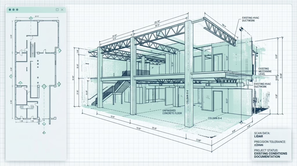
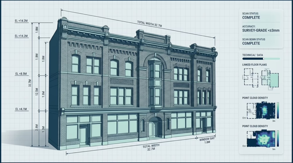
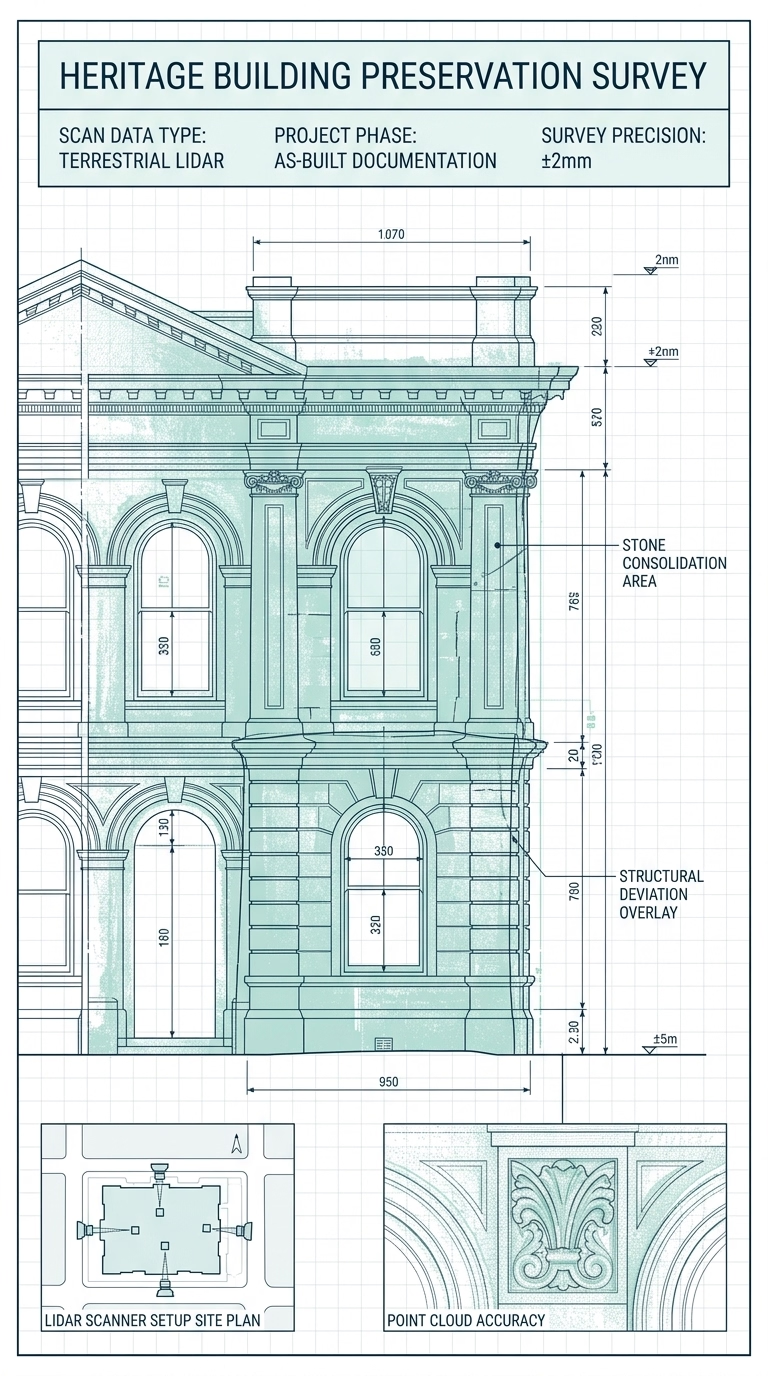
We deploy industry-leading laser scanning technology to capture the complete spatial geometry of any structure — delivering a dense, millimeter-accurate point cloud that becomes the foundation of every drawing we produce.
Reality Capture at the Speed of Light
LiDAR — Light Detection and Ranging — fires thousands of laser pulses per second and measures the precise time each pulse takes to return. The result is a three-dimensional point cloud: a dense digital replica of the physical space, accurate to within a few millimetres.
Unlike tape measures or manual surveys, LiDAR captures everything simultaneously — walls, ceilings, structural columns, ductwork, and irregular geometry — without the risk of missed dimensions or transcription errors. It is the most reliable way to document the existing conditions of any building, regardless of age, complexity, or size.
Why LiDAR Over Traditional Survey
- check_circle Captures entire spaces in a single continuous pass — no return visits
- check_circle Millimeter accuracy eliminates field-measurement errors
- check_circle Non-contact — safe for occupied, fragile, or restricted-access sites
- check_circle Point cloud becomes a permanent, reusable digital record
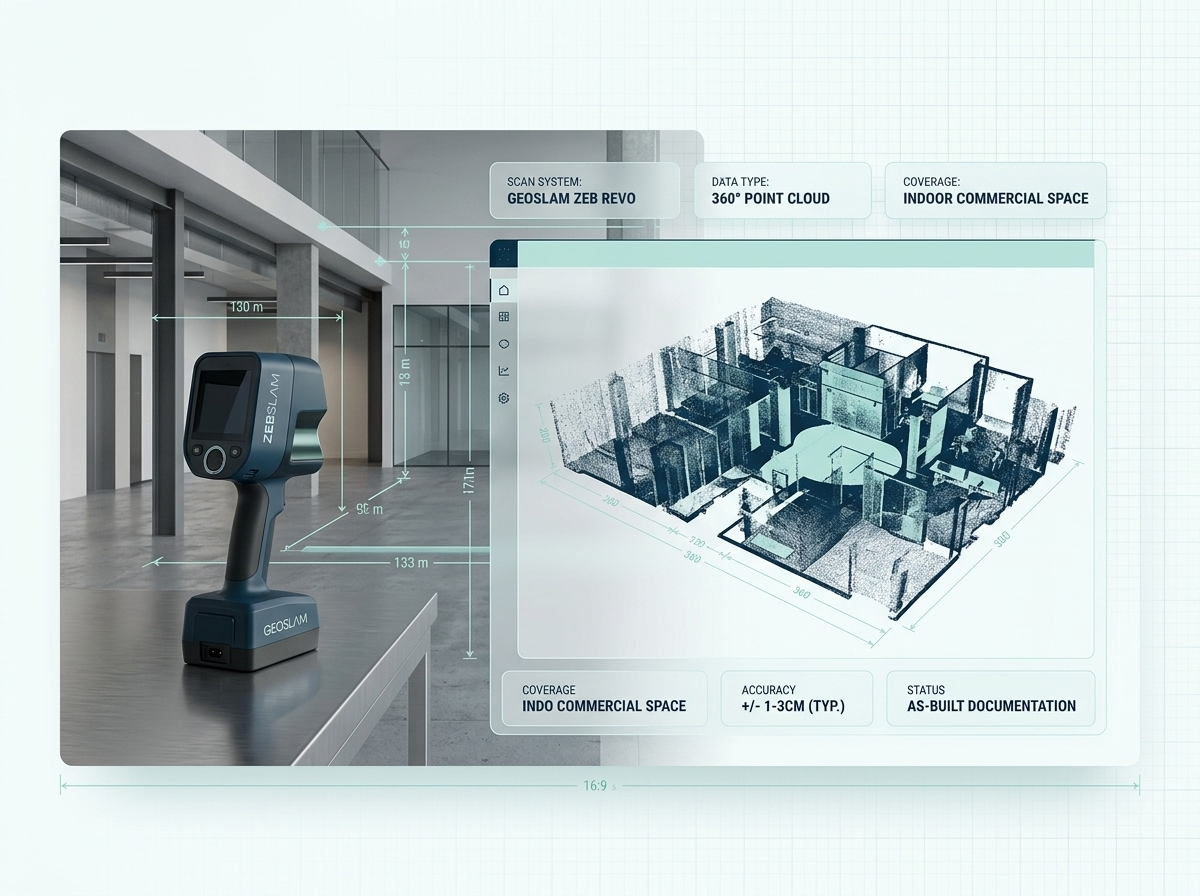
Our Primary Instrument: GeoSLAM Zeb Revo
We operate the GeoSLAM Zeb Revo — a handheld SLAM-based LiDAR scanner purpose-built for interior environments. Its rotating head captures a full 360° field of view as the operator walks through the building, producing a continuous, drift-corrected point cloud without the need for targets or static setups.
- 43,000 pts/s Laser capture rate
- ±3 mm Relative accuracy
- 30 m Effective range
- 360° Field of view
Where We Deploy LiDAR
Every project type benefits from scan-accurate data — from small residential remodels to large-scale industrial facilities.
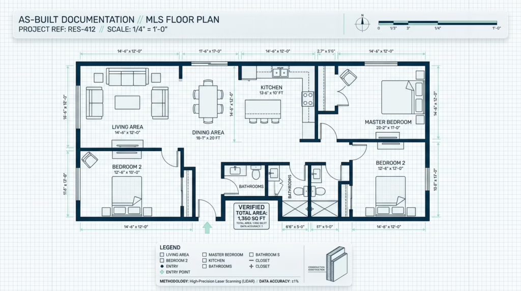
Residential Renovations
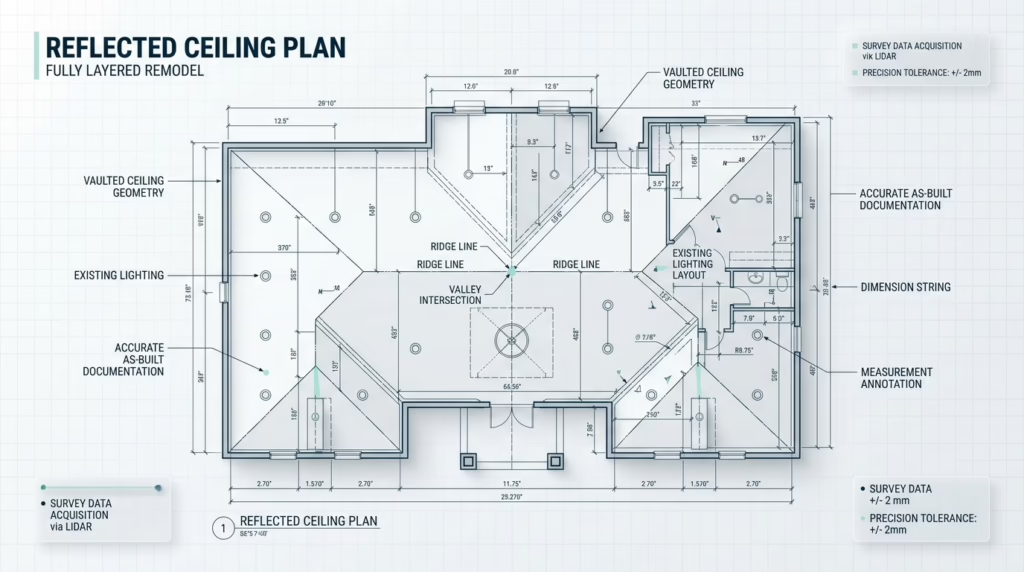
Capture every room of an existing home — including complex additions, non-standard wall angles, and vaulted ceilings — before a single design decision is made.
Single & Multi-FamilyCommercial Fit-Outs
Scan existing office, retail, or hospitality spaces before tenant improvements. Eliminate coordination clashes caused by inaccurate base drawings.
Office, Retail & HospitalityIndustrial & Warehouse Facilities
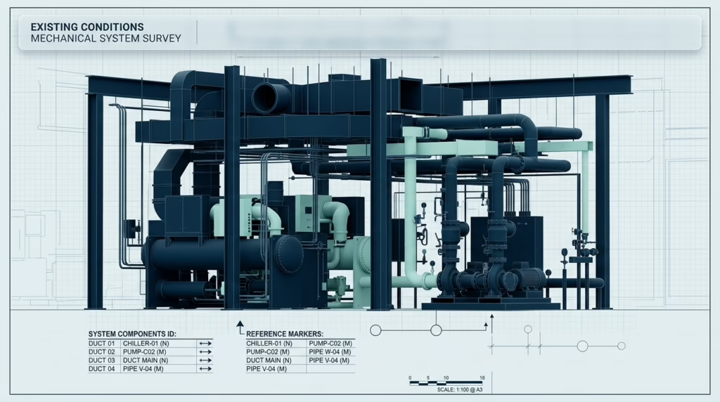
Document large, complex floor plans with high structural density in a fraction of the time a manual survey would require.
50,000+ sq.ftHistoric & Heritage Structures
Non-contact scanning preserves exact as-existing conditions of buildings where invasive measurement is restricted or structurally inadvisable.
Preservation ProjectsStructural & MEP Coordination
Provide engineers and MEP consultants with a verified point cloud so they can model existing conditions before designing new systems.
Engineering & ServicesPre-Purchase Due Diligence
Commission a LiDAR survey before a property transaction to verify stated square footage and identify discrepancies between paper records and reality.
Real Estate & LeasingOur Proven Process
1. Site Scheduling
We confirm access requirements, floor count, and any restricted areas so the scan day runs without delays.
2. LiDAR Capture
Our technician walks the full building with the Zeb Revo, capturing a continuous, drift-corrected point cloud of every accessible space.
3. Point Cloud Processing
Raw scan data is registered, cleaned, and geo-referenced in GeoSLAM Hub and Autodesk ReCap, then reviewed for completeness before drafting begins.
4. Delivery & Handoff
The processed point cloud is delivered in RCP, E57, or RCS format — ready to load directly into Revit, AutoCAD, or your BIM platform of choice.