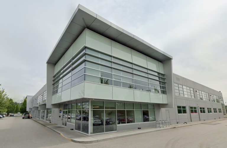
Heritage Property Owner
Shaughnessy, Vancouver, BC
Heritage Residential
Laser Scanning to CAD — As-Built Floor Plans
Heritage House,
Shaughnessy
This project showcases a complete laser scanning to CAD workflow in Vancouver, applied to a heritage residential house in Shaughnessy. The objective was to deliver high-accuracy as-built floor plans for renovation and permit use — using advanced 3D laser scanning (LiDAR) and point cloud to CAD drafting.
The result is a precise, permit-ready drawing set that accurately reflects existing site conditions — critical for heritage renovations, architectural design, and construction planning.
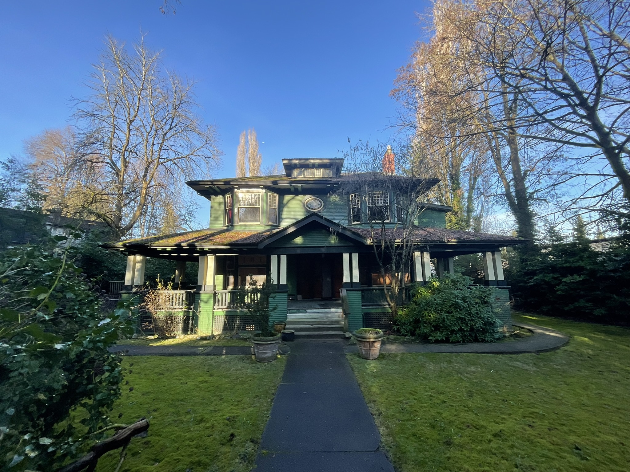
Shaughnessy, Vancouver BC
Measured Building Survey
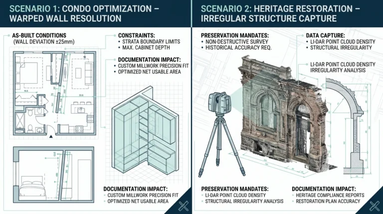
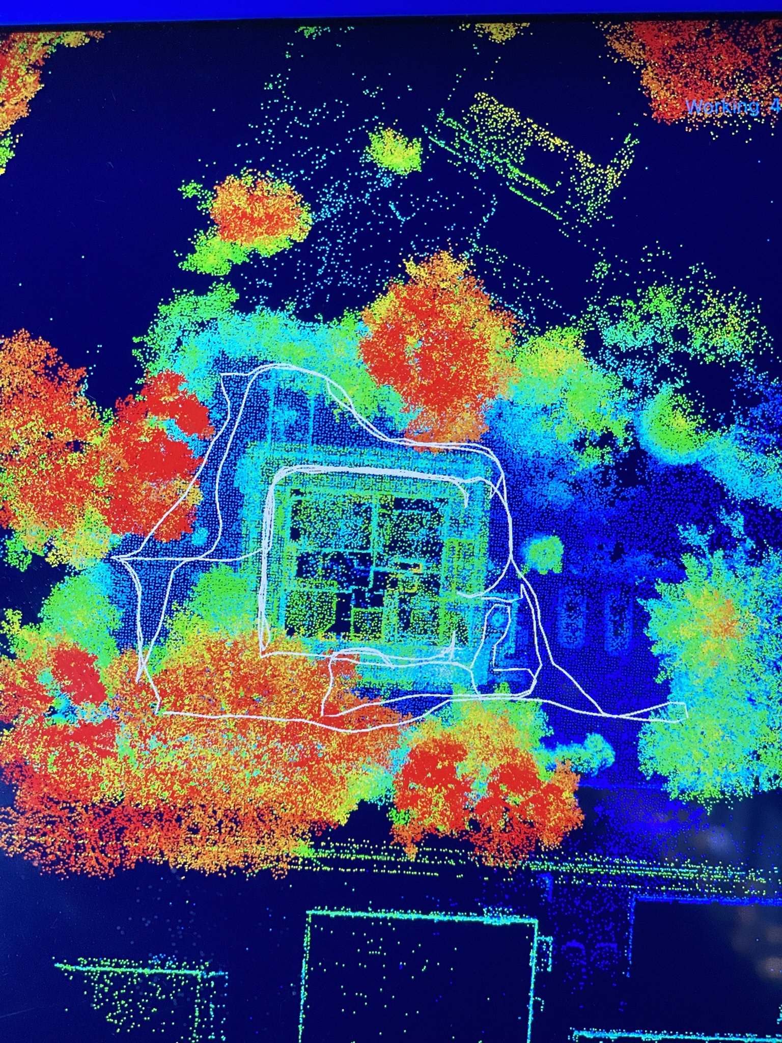
The workflow begins with on-site laser scanning using a handheld LiDAR scanner. Millions of measurements are captured within minutes, creating a point cloud — a dense digital representation of the property. Walls, openings, ceiling heights, and architectural details are recorded with millimeter-level precision.
Compared to traditional measurement methods, 3D laser scanning significantly improves accuracy and efficiency while reducing total site time.
- check_circle Captures irregular geometry and aging structures accurately
- check_circle Non-invasive — ideal for heritage preservation
- check_circle Eliminates errors common in manual measurements
- check_circle Documents the entire property in a single site visit
Scope of Work
- check_circle Full Interior & Exterior Laser Scanning
- check_circle Point Cloud Processing & Registration
- check_circle Scan-to-CAD Drafting of As-Built Floor Plans
- check_circle Delivery of Clean 2D CAD Drawings (PDF + DWG)
Output Formats
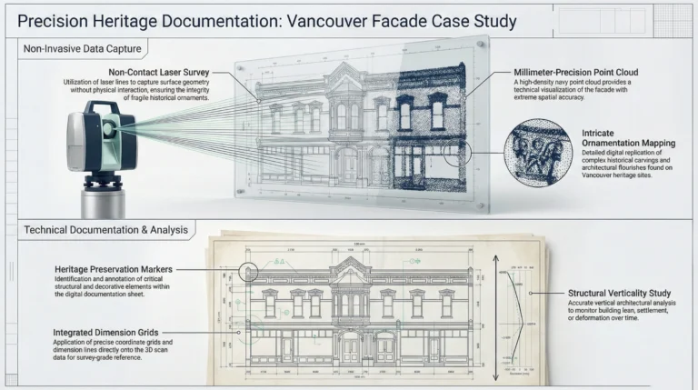
From Point Cloud to Precise CAD Drawings
A structured process that converts raw scan data into accurate, permit-ready documentation.
Building a Complete Digital Twin
After data capture, scans are processed and registered into a unified point cloud model. This aligns multiple scan positions into a single coordinated dataset — forming a complete digital twin of the building.
Millions of accurate data points eliminate guesswork in downstream drafting and provide a reliable base for all subsequent work.
Key Outcomes
- check_circle Clean, accurate point cloud dataset
- check_circle Removal of noise and redundant scan data
- check_circle Precise alignment between all scan positions
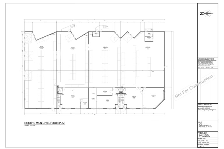
Point Cloud to Accurate Floor Plans
The registered point cloud is imported into CAD software to produce accurate as-built drawings. All building elements — walls, doors, windows, and structure — are traced directly from scan data to ensure dimensional consistency.
The output is clean 2D CAD floor plans widely used in renovation, permitting, and design coordination.
Advantages
- check_circle True as-built conditions, not assumptions
- check_circle Eliminates outdated or missing drawings
- check_circle High-precision documentation for architects and designers
Laser Scanning in the Field
Watch how we capture a complete measured building survey using handheld LiDAR — fast, accurate, and non-invasive.
Key Benefits for Vancouver Residential Projects
From heritage houses to modern renovations — laser scanning delivers results that traditional measurement methods cannot match.
High Accuracy & Reduced Risk
Millimeter-level precision significantly reduces errors and costly rework during construction and permit submission.
Faster Turnaround
Entire homes captured in hours instead of days — accelerating timelines without compromising accuracy.
Complete As-Built Documentation
Point clouds create a permanent digital record of the building for future renovations and maintenance.
Ideal for Heritage Houses
Non-contact scanning preserves delicate structures while capturing full architectural detail.
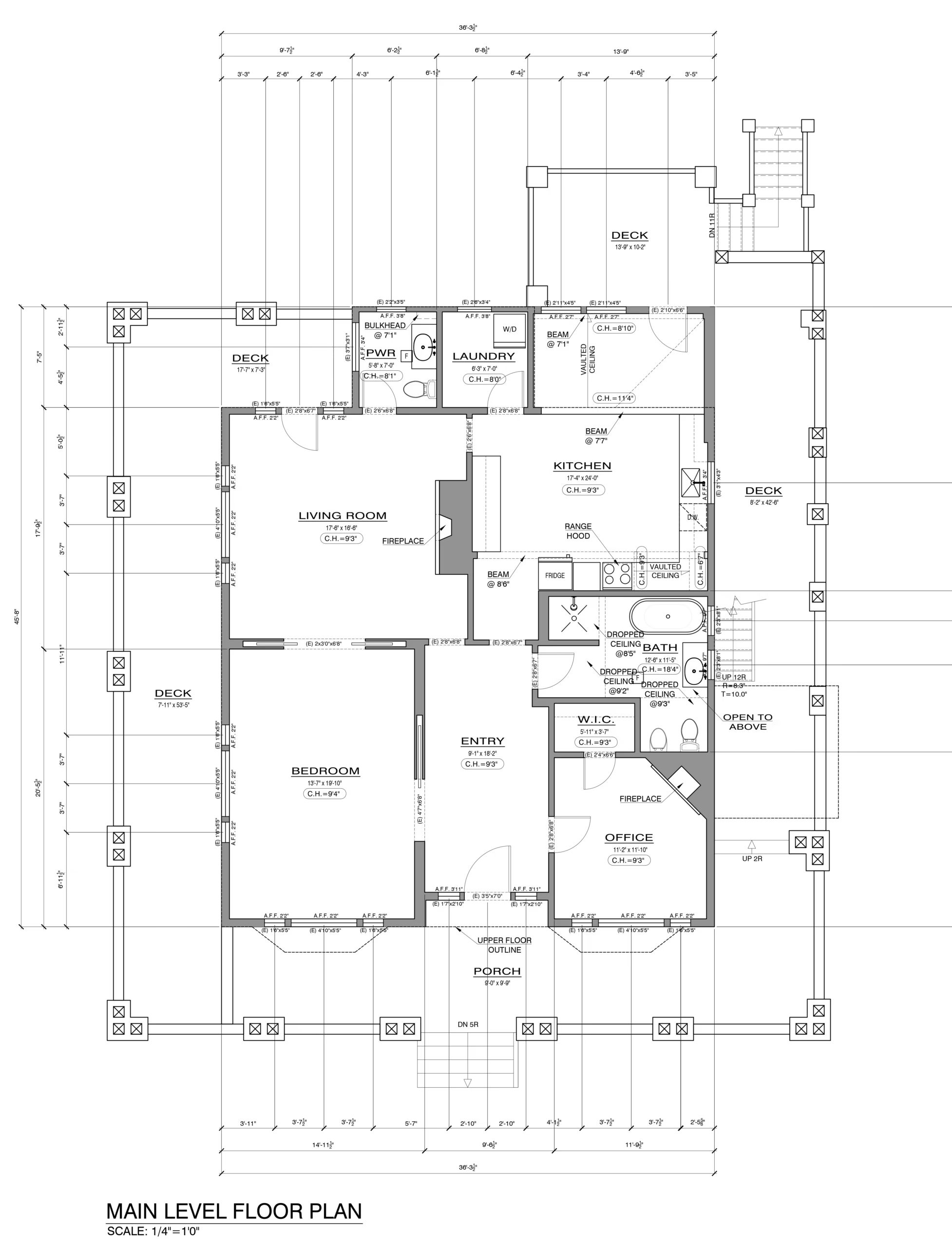
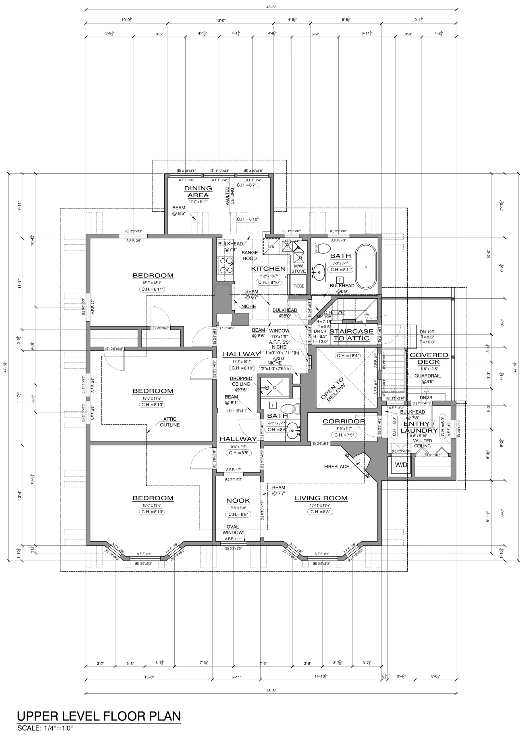
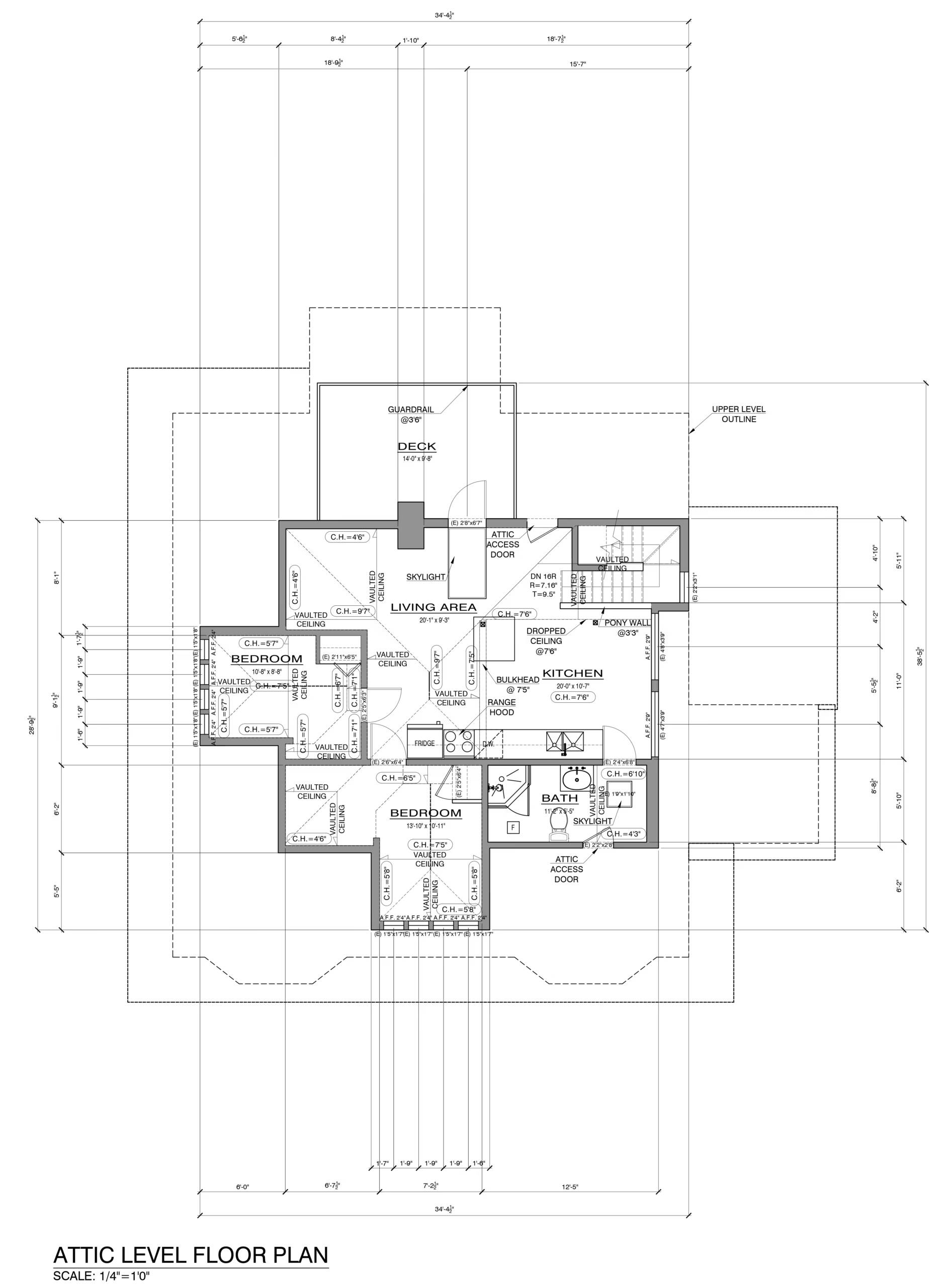
Final As-Built Floor Plans
Permit-ready CAD drawings produced directly from scan data — delivered in PDF and DWG formats.
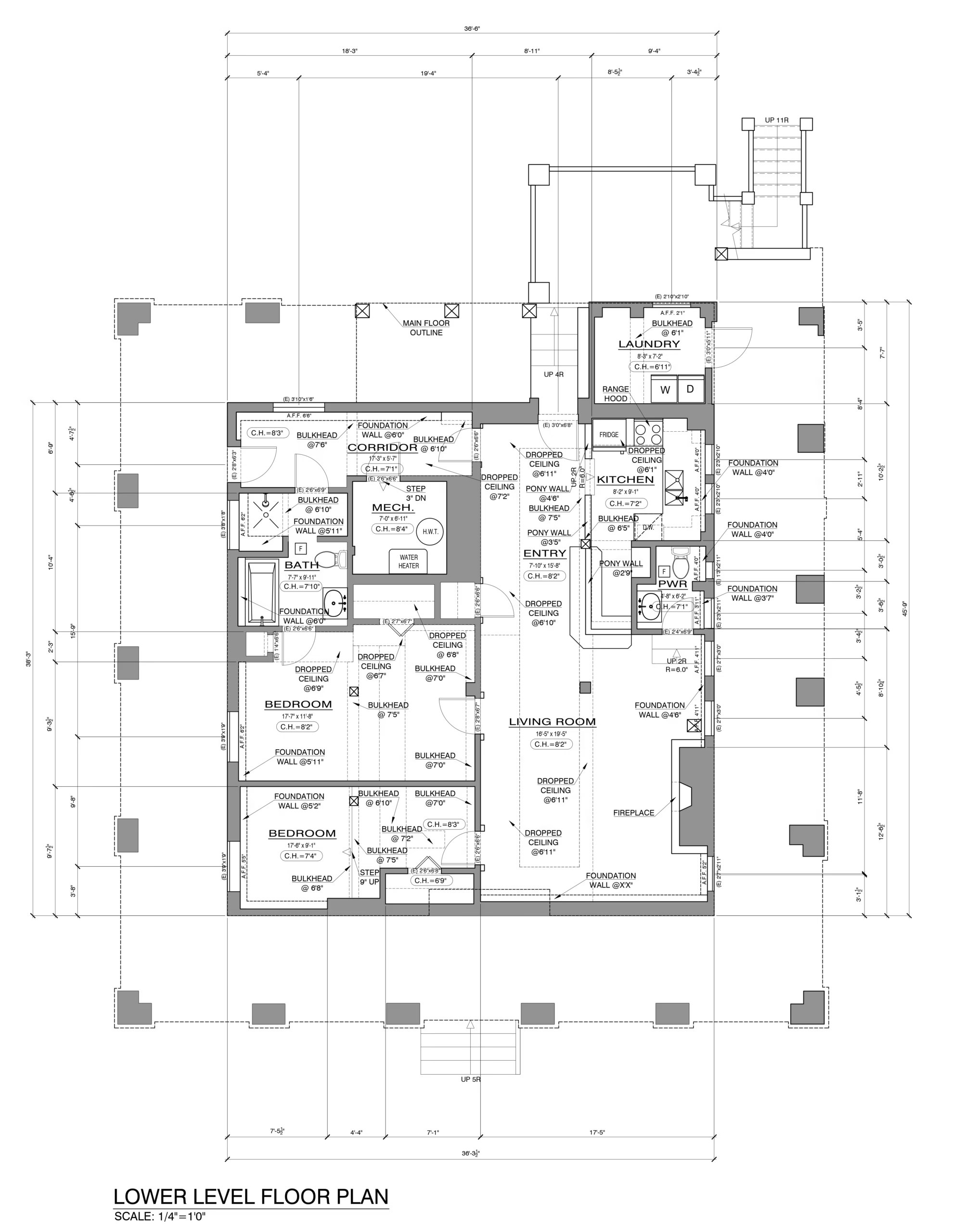
As-Built Drawing — Sheet 01
As-Built Drawing — Sheet 02
As-Built Drawing — Sheet 03
As-Built Drawing — Sheet 04