Accurate As-Built Data
for Every Industry
Laser-scanned existing-condition drawings and BIM models — delivered to architects, contractors, property managers, and homeowners across British Columbia.
Industries We Work With
From residential homeowners to large commercial facilities — every deliverable is tailored to your industry workflow.
As-Built Drawings for Architects & Designers
Accurate existing-condition drawings and Revit models — built from laser scanning to support design, renovation, and permitting. Reduce revisions and start every project with verified data.
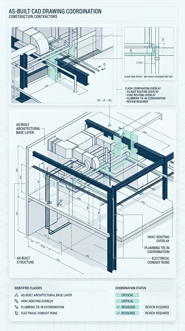
View page arrow_forwardAs-Built Drawings for Contractors & Builders
Accurate site measurements and existing-condition drawings — so you can build with confidence and avoid costly errors.
View page arrow_forwardAs-Built Measurements for Property Managers & Real Estate
Accurate floor plans and BOMA-compliant area calculations for leasing, property management, and asset planning.
View page arrow_forwardAs-Built Measurements for Commercial & Industrial Projects
Accurate laser scanning and existing-condition drawings for large, complex facilities — delivered quickly and with minimal disruption.
View page arrow_forwardAs-Built Floor Plans for Homeowners
Accurate measurements and floor plans for renovations, design, and permits — so your project starts with confidence.
View page arrow_forwardOne Process.
Every Industry.
The same high-accuracy laser scanning workflow — adapted to the specific needs of your project type.
High-Accuracy Laser Scanning
Every project starts with a single on-site LiDAR scan — capturing the complete existing geometry of the building in one visit, regardless of size or complexity.
Fast, Reliable Turnaround
Drawings and models delivered within 24–72 hours of the site visit — clean, organized, and ready for immediate use in your workflow.
Formatted for Your Workflow
Every deliverable is structured for your specific industry — DWG, PDF, RVT, or point cloud — ready to slot into your design, construction, or management process.
Standard Deliverables
Available across all industries — formatted to your project requirements.
AutoCAD (DWG)
Layered, fully dimensioned 2D plans, elevations, and sections — ready for estimating, coordination, and permit submissions.
Print-Ready PDF
Annotated, scaled drawings with title blocks — ready for client presentations, tender packages, and permit applications.
Revit (RVT) Models
Intelligent 3D BIM models with wall types, structural elements, ceiling heights, and MEP routing — the as-built base your team needs.
Point Cloud Data
Raw 3D scan data in RCP / E57 format — for BIM coordination, structural analysis, and direct geometry interrogation.